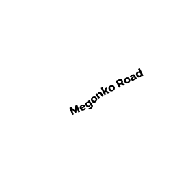
4 MEGONKO RD
Owner Information
SHEAHAN STEVEN J
4 MEGONKO RD
NATICK, MA 01760


Property Details
4 MEGONKO RD is classified as a Single Family Residential (Old style).
The primary structure on this property was built in 1905. There is 3,902ft2 of residential/living space within this property. This property is listed as having 9 rooms.
4 MEGONKO RD is valued at $1,261,000. The land is valued at $542,100 and the structures are valued at $718,900. There is an additional valuation of $95,140 on this property.
This property is in Zone RSA. Confirm with local Zoning Board authorities to ensure there are no overlays or other easements on this property.
The most recent deed for 4 MEGONKO RD is recorded at the local registrar in Book 68634, Page 439. 4 MEGONKO RD was last sold on Wednesday, December 21, 2016 for $1,020,000.
Assessment data from fiscal year 2022.
Flood Data
According to the FEMA National Flood Hazard Layer, this property does not appear to be in a flood zone. It may also be in an area not yet reviewed. Nonetheless, confirm this information prior to taking any action.
To view the flood hazards around this property, create a FEMA "Firmette" Map of the area around 4 MEGONKO RD.
Broadband Internet Providers
| Provider | Type | Bandwidth (mbps) | |
|---|---|---|---|
| VSAT Systems, LLC. | Satellite | 2 | 1 |
| Viasat Inc | Satellite | 100 | 3 |
| Verizon New England Inc. | DSL | 5 | 0 |
| Verizon New England Inc. | Fiber | 940 | 880 |
| Comcast | Cable | 1000 | 35 |
| RCN | Cable | 500 | 20 |
| RCN | Cable | 1000 | 20 |
| EarthLink Business, LLC | Fiber | 0 | 0 |
| GCI Communication Corp. | Satellite | 0 | 0 |
| HughesNet | Satellite | 25 | 3 |
Broadband service provider data from December 2020.
Adjacent Properties
- 6 MEGONKO RD
Single Family Residential owned by SHIRLEY M BROWN 2000 REVOCABLE TRUST - 7 MEGONKO RD
Single Family Residential owned by MCCOLL THOMAS R - 214 NORTH MAIN ST
Undevelopable Residential Land owned by SHIRLEY M BROWN 2000 REVOCABLE TRUST - 220 NORTH MAIN ST
General Office Buildings owned by LAKEWOOD NORTH MAIN REALTY TRUST - 5 MEGONKO RD
Single Family Residential owned by ANDERSON SUSAN K - 5 MEGONKO RD
Undevelopable Residential Land owned by SHEAHAN STEVEN J